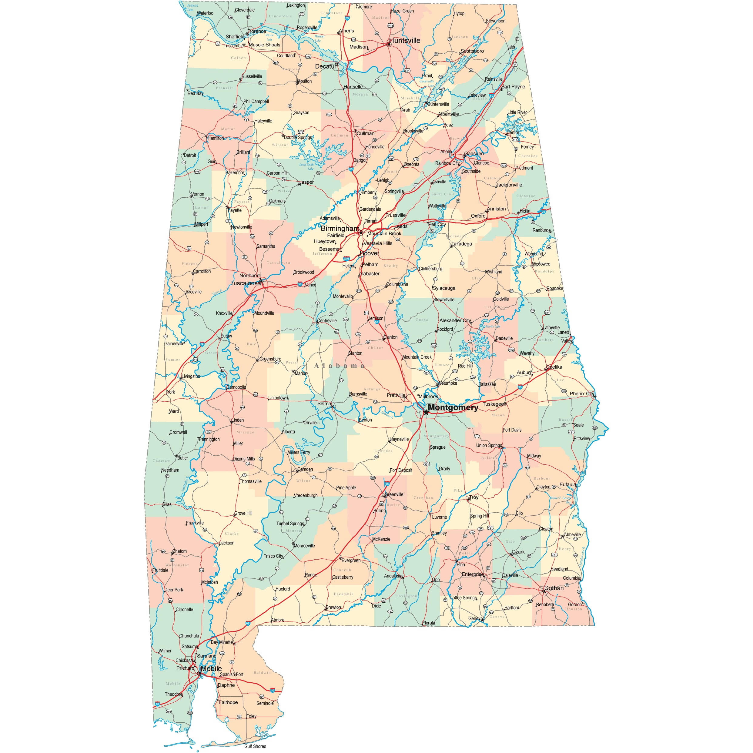
Alabama Road Map
 Alabama Mountain Road, with Autumn Colors
Alabama Map Navigation
To display the map in full-screen mode, click or touch the full screen button. To zoom in on the Alabama state road map, click or touch the plus (+) button; to zoom out, click or touch the minus (-) button. To scroll or pan the zoomed-in map, either (1) use the scroll bars or (2) simply swipe or drag the map in any direction. (The scrolling or panning method you use will depend on your device and browser capabilities.) At any time, you can display the entire Alabama road map in a new window or print this page, including the visible portion of the map.

Alabama Map Legend

Alabama Map Scale Of Miles

Alabama Interstate Highways
Alabama's Interstate Highways connect its major cities and facilitate travel between Alabama and its neighbors.
- I-10 traverses southern Alabama, bisecting the city of Mobile and linking Mississippi to the west with Florida to the east.
- From Alabama's western border with Mississippi, I-20 travelers can drive eastward through Tuscaloosa and Birmingham before leaving the State at its eastern border with Georgia.
- From its western terminus in Birmingham, I-59 travelers can drive northeast into Georgia.
- From its southern terminus in Mobile, I-65 extends northward through Montgomery and Birmingham before leaving Alabama at its northern border with Tennessee.
- From its western terminus in Montgomery, I-85 travelers can drive northeast into Georgia.
Alabama's auxiliary Interstate Highways facilitate travel in Alabama's metropolitan areas.
- I-165 provides access to downtown Mobile, joining with I-65 in Chickasaw.
- I-359 provides access to downtown Tuscaloosa, joining with I-59 south of the city.
- I-459 provides an alternate route through the Birmingham area, traversing the city's southeastern suburbs.
- I-565 provides access to the city of Huntsville, joining with I-65 near Decatur.
Alabama Scenic Routes
Also crossing through parts of Georgia and Tennessee, Lookout Mountain Parkway is a scenic 80-mile stretch of highway that traverses the ridge of Lookout Mountain. Take the exit to Noccalula Falls Park, where you can hike past a 90-foot waterfall, view a pioneer homestead, visit a petting zoo for the kids, and even play mini-golf. Little River Canyon, Sequoyah Caverns, and Cloudland Canyon State Park are a few more stops that showcase the beauty of Alabama along this breathtaking mountainous route. More information about scenic roads in Alabama is available on the Alabama Scenic Byways website.
Alabama Road Travel Resources
For more information about Alabama's roads and transportation infrastructure, visit the Alabama Department of Transportation website. For Alabama road traffic conditions, visit the Federal Highway Administration's Alabama Traffic Information page.
Alabama-Map.org is a State Maps reference source.