
Alabama Topographical Map
Static Alabama Topo Map
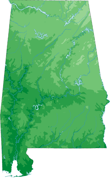
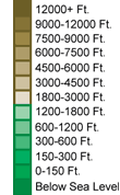
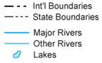
This section features a topographical map of Alabama as well as a map legend that specifies elevation ranges and indicates their corresponding map colors.
Map Legend |
 |
|
 |
Alabama Topographical Features
Alabama's highest mountain is Cheaha Mountain, whose peak is 2,407 feet above sea level. Alabama's lowest elevation is sea level, at the Gulf Of Mexico. Alabama regions include the north central Appalachian hills, the northwestern interior plateaus, the eastern Piedmont, and the southern coastal plain. Major rivers in Alabama include the Mobile, Alabama, Tombigbee, Tennessee, Chattahoochee, and Conecuh.Interactive Alabama Topo Map
This section features a topographical map that can be zoomed and panned to show the entire State of Alabama or a small portion of the state. To zoom in or out on the map, use the plus (+) button or the minus (-) button, respectively. To pan the map in any direction, simply swipe it or drag it in that direction. At high zoom levels, the contour lines on this Alabama map can help outdoorsmen, land developers, and others to plan their routes and activities more efficiently.
Copyright © 2005-2024 State-Maps.org. All rights reserved.
Alabama-Map.org is a State Maps reference source.
Alabama-Map.org is a State Maps reference source.